
Drone mapping
Mapping data for planning and design
Stockholm Drone Teknik AB provides drone mapping for construction, development, land management and infrastructure. Through systematic aerial photography or laser scanning, we collect georeferenced data that can be processed into maps and digital models.
Drone mapping for different projects
The method suits sites requiring up-to-date information for planning, design or progress monitoring, including construction sites, stockpiles, quarries, roads and large land areas. Boundaries and the required level of detail are agreed before flight.
Photogrammetry and LiDAR
Photogrammetric mapping uses overlapping images that can be processed into orthophotos, point clouds and surface models. LiDAR measures distances using laser pulses and can be suitable for complex terrain or vegetation. We select the method according to project needs and conditions.
Georeferencing and quality assurance
We use RTK equipment and surveyed ground references where necessary to improve georeferencing. Coordinate systems, resolution, accuracy and checkpoints are agreed in advance. Quality depends on flight conditions, terrain, imagery and processing.
Deliverables and applications
Deliverables may include orthophotos, point clouds, elevation models and mapping data in agreed file formats. The material can be used in GIS, CAD and other design tools.
Planning and quotation
We need the site location and size, required accuracy, delivery formats and timeframe. We then develop a feasible approach to drone surveying.
Drone mapping – technical data for design
Before an assignment we define the level of detail and whether the result will be used for overview, geometric analysis or design. Repeat drone mapping can use the same boundaries and comparable flight parameters. This helps identify changes between survey dates and compare completed work with earlier documentation.
Drone mapping – delivery requirements
Clients should specify whether the map will be used in GIS, design software or visual documentation. We agree on site boundaries, coordinate system, required resolution and checkpoints. Drone mapping can provide complementary orthophotos, point clouds and elevation models. Information about Swedish coordinate and elevation systems is available from Lantmäteriet. For repeat surveys, boundaries and reference systems should be comparable between visits.
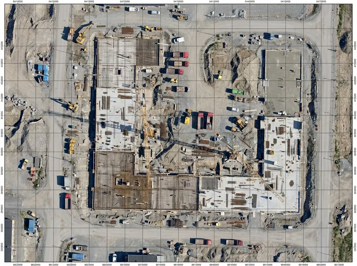
An orthophoto is especially useful when the client needs a current overview that can be overlaid with design information.
Drone mapping: preparing your project
For a useful mapping deliverable, start by defining the area of interest and how the data will be used. A construction team may need an overview of access routes, work zones and materials, while a design consultant may require georeferenced information that can be combined with existing drawings. Where several datasets are to be compared, it is important to agree on the same coordinate reference system and survey boundaries. We review these requirements before data collection so that the selected equipment and processing workflow match the intended purpose. We can also discuss whether the project needs a one-off survey or regular updates.