
Drone LiDAR and point cloud training
Drone LiDAR with Stockholm Drone Teknik AB. Learn how airborne laser scanning captures three-dimensional information about terrain, vegetation, buildings and infrastructure. This introductory course connects survey planning, point cloud processing and quality control.
What you will learn
- LiDAR principles and laser returns
- differences from photogrammetry
- flight planning and sensor settings
- LAS and LAZ files
- classification, ground points and terrain models
- visualisation and export.
Practical workflow and applications
Point density alone does not guarantee a useful result. Flight lines, speed, coverage, positioning and the target surface must match the project requirements. In a wooded area, inspect the actual ground returns before building a terrain model. Do not hide coverage gaps by indiscriminate interpolation. Examine overlapping flight strips, remove unwanted points where justified, document classification choices and verify coordinate systems before export. Preserve original data separately from processed versions.
Who is this course for?
Drone pilots, GIS users, survey technicians, forestry and construction consultants who want to work with LiDAR data.
Course duration and price
SEK 12,900 per person excluding VAT · 2 days
15% company discount for more than two participants from the same company. Tailored company training from SEK 35,000 excluding VAT for companies with at least three participants. The course introduces practical point cloud workflows, rather than advanced geodesy.
Further information and bookings
Find additional information at the relevant official resource. Explore all our drone training courses. Contact Stockholm Drone Teknik AB for course dates and arrangements.
Planning a drone LiDAR survey
Before starting a survey, define what the customer needs to determine from the point cloud. A terrain model requires reliable ground coverage, whereas documentation of structures or vegetation may require a different collection strategy. Flight height, speed, overlap and sensor settings affect data quality. Examine the environment and choose settings that are appropriate for the object, mission and aircraft capabilities. The aim is not simply to collect many points, but to collect useful data for the intended purpose.
Working with LAS and LAZ data
A point cloud contains three-dimensional coordinates and may include additional information about each return. Once the data has been imported, inspect the project from several viewpoints. Look for missing sections, unusual points or discrepancies between strips. Keep the original files separate so that the results can be reproduced. Classification can help distinguish ground, buildings and vegetation, but it needs to be checked against the actual scene.
Ground models in wooded environments
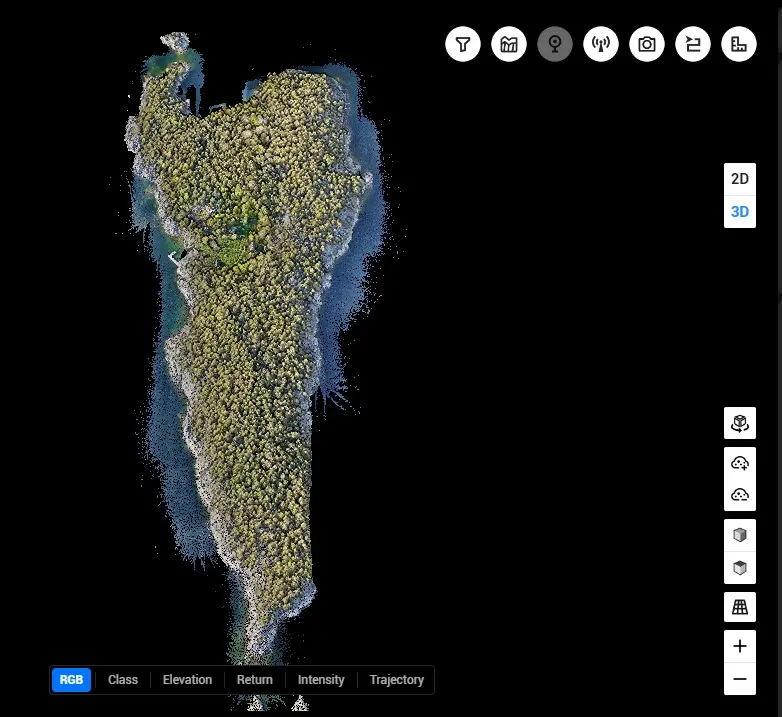
A survey of woodland illustrates the value of drone LiDAR. Laser returns may provide information about the ground below portions of the canopy, but the availability of ground points depends on the conditions. Check whether the ground classification adequately represents terrain variation before creating a digital terrain model. If coverage is insufficient, document the limitations or discuss additional collection rather than hiding gaps through excessive interpolation.
Quality assurance and delivery
Review the coordinate reference system, height reference and file formats before sending data to a client. When multiple strips overlap, examine whether their geometry agrees. Preserve raw data, document filtering and classification steps and communicate limitations in the delivery. A recipient may need a classified point cloud, elevation model or another derived product. Drone LiDAR is useful when its performance and limitations are understood, and the result is evaluated according to project requirements. The course provides a practical introduction to these workflows, rather than advanced geodetic theory.
Preparing for your course
The course also highlights the importance of distinguishing raw returns from processed products. Discuss how a terrain model differs from a surface model and why selecting an appropriate classification depends on the customer’s needs. Evaluate coverage and discuss what should be included in a project report. A transparent delivery should identify the reference system and document relevant assumptions.