
DTM and DSM – drone elevation models
Elevation data for land and construction projects
Stockholm Drone Teknik AB produces drone elevation models for land design, terrain analysis and monitoring. Using photogrammetry or LiDAR, we collect elevation data and process it into digital models tailored to the client’s requirements.
The difference between DTM and DSM
A digital terrain model (DTM) describes the ground surface, with buildings and vegetation classified out as far as possible. A digital surface model (DSM) describes the visible surface including those objects. The models serve different purposes and are not interchangeable.
Elevation models for design and analysis
DTM can support terrain profiles, slope analysis, site planning and preliminary earthwork calculations. DSM provides information about vegetation, buildings and other above-ground objects, useful for visualisation and analysis.
Data collection and processing
We select an appropriate sensor based on vegetation, ground conditions and survey requirements. Photogrammetry uses image matching, while LiDAR measures distances directly. The point cloud is processed and classified according to the desired model.
Accuracy, resolution and coordinate systems
The client’s requirements for vertical reference, coordinate reference system, cell size and accuracy are agreed before the assignment. Dense vegetation, water and limited visibility can affect results. We document our method and relevant limitations.
Deliverables for GIS and CAD
Elevation models can be delivered in agreed raster or point data formats, together with orthophotos and point clouds when required. Contact us with your project area and technical requirements for a quote.
Drone elevation models for earthworks
When planning excavation, filling or road routes, a terrain model can help evaluate variations in ground height. Before delivery, we check that vertical and horizontal reference systems match the rest of the project data. Clients should specify whether the model is intended for visualisation, design or further calculations.
Drone elevation models for design
An elevation model should include its coordinate system, vertical datum, cell size, survey date and method. This is especially important when comparing several deliveries or integrating them with existing drawings. SWEREF 99 and RH 2000 are commonly used in Sweden; the appropriate system depends on the project. See Lantmäteriet’s information on reference systems. A terrain model can be complemented by point clouds and laser scanning to facilitate inspection of individual areas.
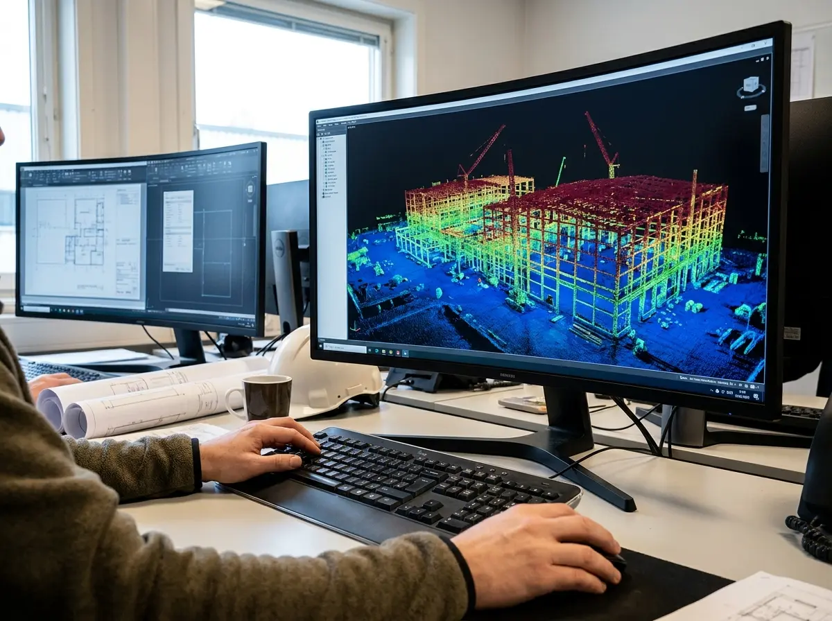
A classified point cloud can be used to create a terrain or surface model. It also allows individual survey points to be examined before the model is exported into the client’s design tools.
Choosing the right model for your project
A terrain model is useful when the focus is the ground itself, for example when a designer needs to explore slopes, drainage paths or changes in level across an area. A surface model is more suitable when above-ground objects are relevant to the analysis. In both cases, the intended use determines the required resolution and the level of confidence in the result. It is important to distinguish between a visually detailed model and a model that has been checked against the project’s survey requirements. We discuss these requirements before the flight and document any limitations that affect interpretation.
Preparing a delivery specification
For an engineering project, specify the coordinate and height reference systems and the software that will receive the data. Let us know if you need additional source data, such as a point cloud, to inspect the model. Where the dataset will be compared with an earlier survey, a consistent definition of the survey area, reference system and calculation method makes the comparison easier. We can discuss what metadata should accompany the delivery. A clearly defined specification also helps avoid unnecessary conversion work and gives each project participant a common understanding of what the model represents.