
Drone mapping and photogrammetry – 4-day course
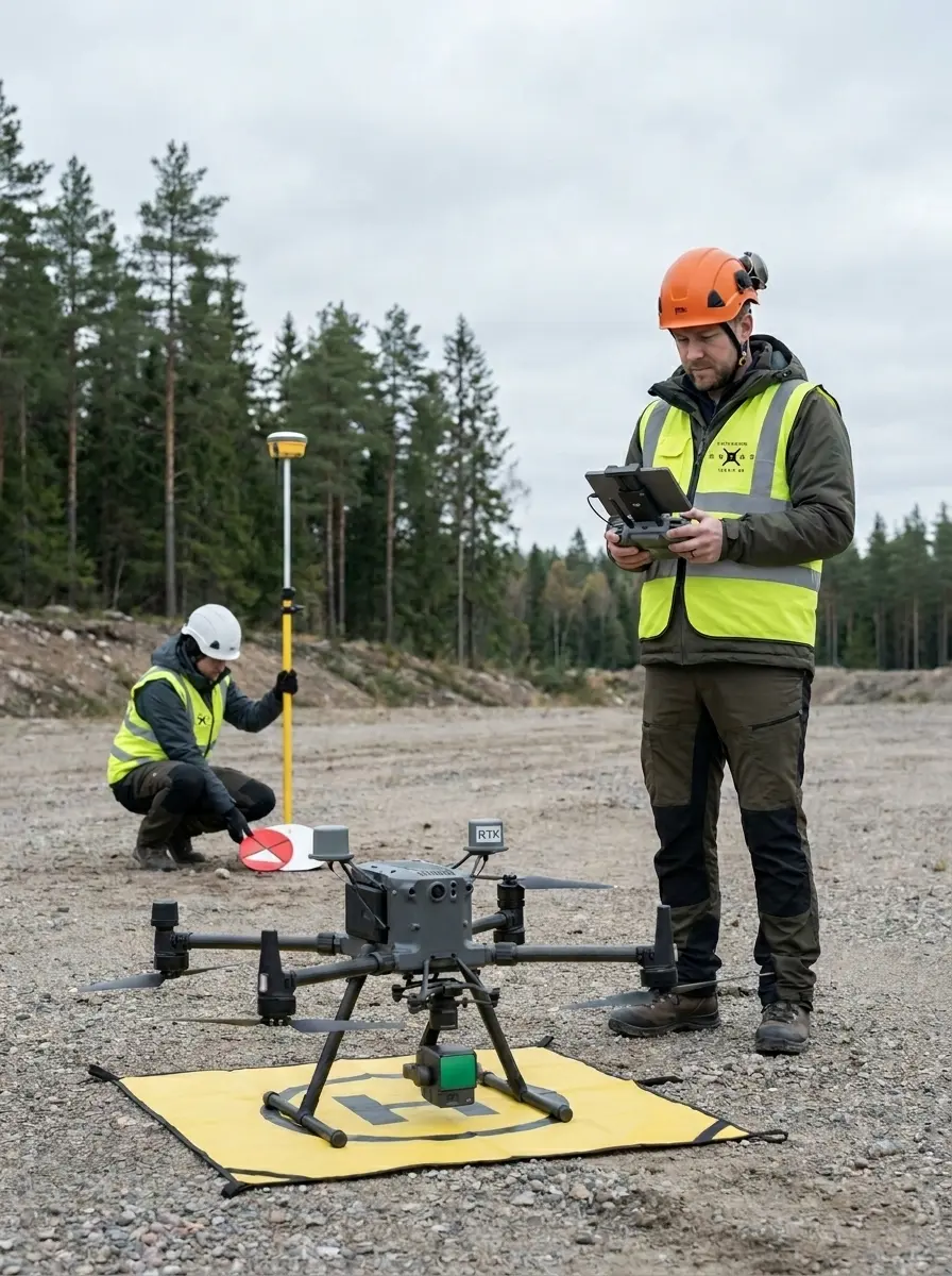
Drone mapping and photogrammetry with Stockholm Drone Teknik AB. Learn the complete drone mapping and photogrammetry workflow, from flight planning and georeferenced image collection to orthophotos, point clouds and elevation models. Training focuses on surveying, construction and technical documentation using Agisoft Metashape.
What you will learn
- Ground coverage, overlap, GSD and image collection
- RTK, ground control points and independent checkpoints
- SWEREF 99 and RH 2000
- image alignment and georeferencing
- orthophotos, point clouds, elevation models, volume calculations and GIS/CAD export.
Practical workflow and applications
Photogrammetry reconstructs geometry using overlapping images from several perspectives. Flight height and image overlap must suit terrain, resolution and project requirements. Check image quality, coverage, coordinates and camera alignment before generating final products. RTK can support positioning but does not eliminate independent quality checks. In a construction survey, consistently use the agreed coordinate and height reference systems to compare data across dates. Export the products the customer needs and document limitations, accuracy checks and processing decisions.
Who is this course for?
Survey technicians, construction companies, drone pilots and consultants working with georeferenced maps and models.
Course duration and price
SEK 14,900 per person excluding VAT · 4 days: 3 theory and processing, 1 practical
15% company discount for more than two participants from the same company. Tailored company training from SEK 39,000 excluding VAT for at least three participants. Agisoft Metashape is the main software; Pix4D and DJI Terra may be covered on request.
Further information and bookings
Find additional information at the relevant official resource. Explore all our drone training courses. Contact Stockholm Drone Teknik AB for course dates and arrangements.
Drone mapping and photogrammetry: planning for quality
Photogrammetry uses overlapping photographs taken from different viewpoints to reconstruct geometry. The quality of the final model depends on the quality of the input data and the processing choices. Before collecting images, define project requirements, coverage, ground sampling distance and the desired products. Consider terrain variation, obstructions, illumination and the possibility of image blur. Reliable flight planning can reduce the need to repeat a survey.
RTK, control points and coordinate systems
Georeferenced datasets must use an appropriate horizontal and vertical reference system. RTK can assist positioning, but independent checks remain important. Understand the difference between ground control points used to orient the model and checkpoints used to assess the result. Examine discrepancies and consider whether they meet the agreed project requirements. In Swedish projects, coordinate and height systems such as SWEREF 99 and RH 2000 may be relevant.
From image alignment to digital products
In Agisoft Metashape, first inspect image orientation before proceeding to time-consuming processing. Check the reconstructed geometry and investigate missing areas or unexpected artefacts. Depending on the customer’s requirements, create an orthophoto, a point cloud or an elevation model. A visually convincing result does not necessarily guarantee geometric accuracy. Drone mapping and photogrammetry require both visual and quantitative checks before delivering data.
A construction site mapping example
A contractor may want an orthophoto and elevation data to monitor changes over time. Plan the operation according to the site’s activities and environmental conditions, use the agreed coordinate system and evaluate the result independently. When comparing surveys, document differences in collection or processing methods so that apparent changes are not confused with processing effects. Export suitable GIS or CAD formats and check that the recipient can open the files. The four-day drone mapping and photogrammetry course connects practical data collection to the processing workflow and final deliverables.
Preparing for your course
A successful survey depends on clear scope, consistent field procedures and quality checks. In a repeat survey, compare compatible products and account for different acquisition conditions. Document the workflow and any limitations that could affect subsequent measurements. By linking field collection with processing, you can identify issues earlier and deliver georeferenced data suited to the project.