
Drone architectural photography and construction projects
Showcase architecture and construction projects
Stockholm Drone Teknik AB offers drone architectural photography for architects, construction companies, property developers and communications teams. We combine considered composition and technical flight planning to show buildings’ forms, materials, surroundings and relationship to the cityscape. Images are adapted to marketing, documentation or presentation of completed architecture.
Drone architectural photography for property development
Ground photographs often show entrances and façades, but aerial perspectives reveal volume, roofscapes, green areas and surrounding infrastructure. We plan camera angles according to asset characteristics and client requirements. Varied framing can provide broad views and focused architecture images in a single shoot.
Construction photography throughout the building process
During recurring visits, we document progress from earthworks and structural erection to completion. Comparable angles over time make progress easier to communicate to clients, investors and other stakeholders. Documentation can be supplemented with building inspection and project monitoring when the objective is reviewing visible anomalies rather than producing presentation images.
Images adapted to different channels
Before the assignment, we review where images will be used. Websites may require landscape images with space for text, while social media often needs portrait framing. Project presentations, annual reports and print have different composition and resolution requirements. Planning multiple uses before shooting creates a more coherent collection.
Light, perspective and editing
Sun direction significantly affects how façades, details and materials appear. We plan photography based on forecasts, building orientation and desired expression. Images are processed with adjusted exposure, colour balance and contrast. Specific delivery and colour profile requirements can be agreed when needed. Editing should support clear presentation without changing the building’s actual design.
How we carry out an assignment
We begin with a brief review of the asset, audience and needs. We then assess flight conditions, possible launch sites, obstacles and restrictions. When photographing near an active construction site, we coordinate with the responsible person. During flight, we follow a shot list but adapt composition to light and the asset. Afterward, we select images according to the agreed scope and deliver finished material digitally.
Combine architectural photography and drone video
For a coherent project presentation, still images can be combined with drone video for marketing. Aerial photos may be used on a project page, while video shows movement through the area and places the building in its geographical context. We adapt production to communication goals and publication formats.
Frequently asked questions about drone architectural photography
Can photography take place while work is ongoing? Yes, if flights can be coordinated safely. Can we book several shoots? Yes, scope and intervals are agreed together. What happens in bad weather? Flights may need rescheduling if light, wind or rain prevents safe operations or appropriate image quality.
Request a quote for architectural photography
Specify the project address, buildings to photograph, preferred timing, number of images and intended use. We will propose an approach tailored to your project. Read more about aerial photography and drone video.
Shot planning with architects and clients
Before an assignment, identify which architectural elements should be highlighted, such as the building’s form, courtyard, materials or relationship to surroundings. We adapt the shot list to the project’s visual identity and plan varied perspectives for a useful selection. The same building can also be documented from multiple directions and at different times.
Architectural photography for portfolios and project presentations
Professional aerial images can provide a more complete presentation than ground images alone. Architects and developers can use material for portfolios, presentations and project websites. For recurring documentation, relevant reference angles and clear dates are important.
Flights and publication of imagery
Conditions are assessed before the assignment. Depending on the area photographed and how images will be distributed, a dissemination permit may be required. Read more about dissemination permits from Lantmäteriet. We plan the assignment around these requirements and the client’s intended use.
Drone architectural photography for project presentations
We can plan views that show building volume, façade materials and the relationship to surrounding streets and landscapes. Photography is adapted to sun direction, weather and intended use. Both wide and closer perspectives can be included for presentations.
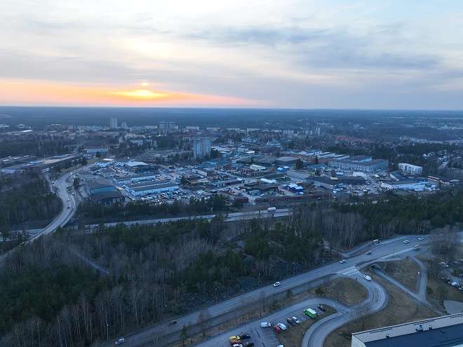
Drone architectural photography for different project stages
Drone architectural photography can document the surroundings before construction, the development during construction and the finished property after handover. For a coordinated series, we agree on viewing angles and lighting preferences. This makes drone architectural photography particularly useful when the same project will be presented to different audiences.